iLogMap: a new method to “flatten” the surface of the heart and simulate arrhythmias
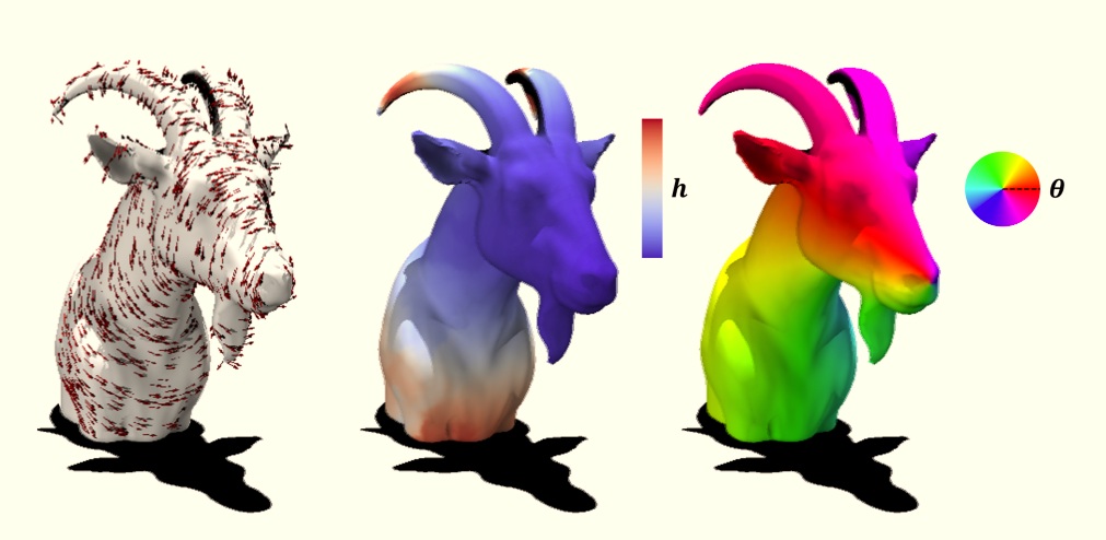
Researchers at the Millennium Institute iHEALTH, in collaboration with the Università della Svizzera italiana and the Università di Trento, have developed iLogMap, a mathematical tool that makes it possible to represent curved surfaces in a simpler way. The team is already using it to simulate arrhythmias in digital twins of the heart, that is, computational models that reproduce the shape and function of a patient’s organ.
The underlying challenge is an old one: how to “flatten” a curved surface without losing information about its actual shape. It is the same problem faced by those who draw maps of the Earth, a sphere, on a flat sheet of paper. One technique used to address it is known as geodesic polar coordinates (GPC).
“GPCs are a way of representing curved surfaces, such as the surface of a sphere, in a simpler manner. To do this, you take a reference point and compute the shortest path from that point to any other point on the surface. To describe that path, we need to know two things: how long it is and in which direction it goes,” explains research engineer Tomás Banduc.
With these two pieces of information, distance and direction, curved objects can be treated as if they were flat, without losing their important features. “GPCs are used in computing to study different types of geometries. In our group, we are particularly interested in using them to simplify the simulation of arrhythmias in digital models of the heart,” Banduc adds.
The novelty of the work lies in how these coordinates are computed. “iLogMap is a method that allows GPCs to be constructed using complex numbers. It takes a starting point on a surface, computes the distances to every point, and uses that information to determine the direction of each path,” the researcher explains. To achieve this, the method establishes a consistency relationship between distances and directions, relying on a special way of representing direction within that number system.
Why was a new method needed? According to Banduc, existing tools work well in many cases but have limitations: “They do not make it easy to adapt the way distances are measured in the geometry, they can cause problems when the surface has boundaries or highly curved regions, and they cannot be applied directly to solid volumes.”
iLogMap aims to address those points. “It allows us to change the way distances are measured on a surface and to reduce the distortions that may arise near boundaries or in regions with complicated properties. It can also be extended to work in volumes, which only requires incorporating one additional measurement of direction,” he says.
The team is already planning its next steps. “The next step is to study in greater detail how the method behaves when applied to more complex, higher-dimensional objects. In these cases, the information about the different directions overlaps, which makes the computations more challenging,” Banduc notes.
The paper, titled “iLogMap: Geodesic Polar Coordinates Parameterization with the Magnetic Laplacian,” is available as a preprint on arXiv (arXiv:2609.10503). It was developed by Tomás Banduc and Francisco Sahli, both from the Pontificia Universidad Católica de Chile and iHEALTH, together with Simone Pezzuto, from the Università della Svizzera italiana and the Università di Trento.
